National Cadaster

Angola, 2015-2021

Geodata established a national cadastral system and database, serving Angola’s urban areas. The system includes accurate parcel-based land information, aerial imagery, photogrammetric mapping, historical maps and addresses.

Project story

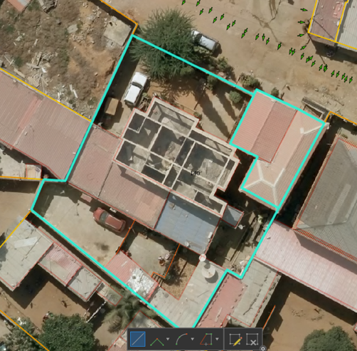
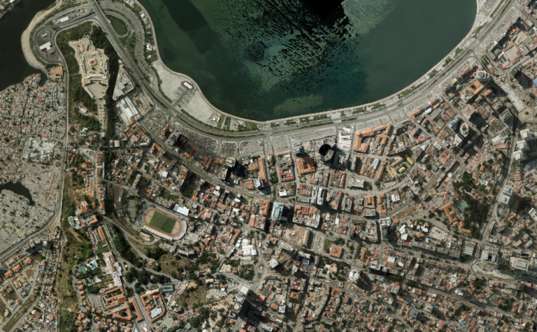
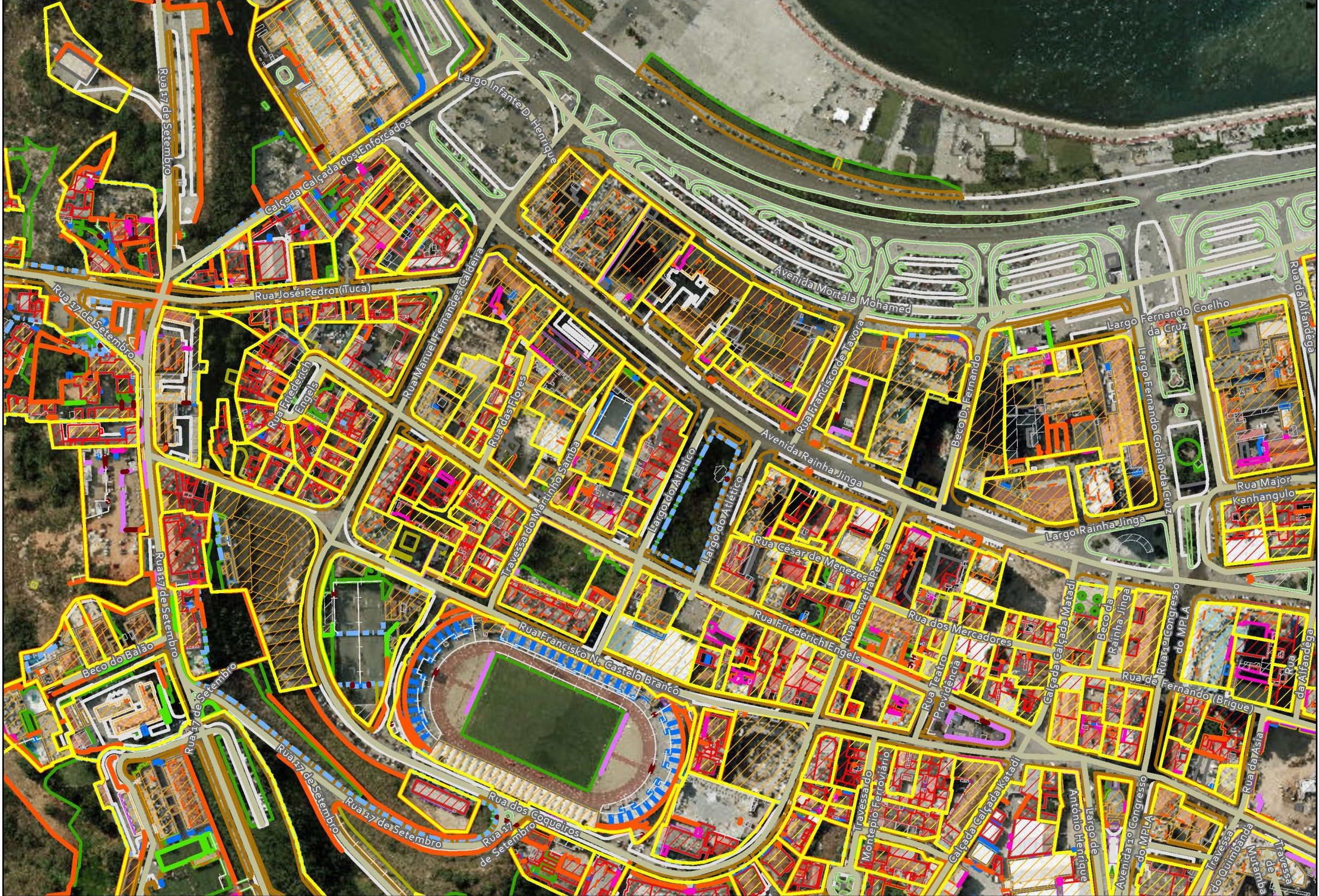
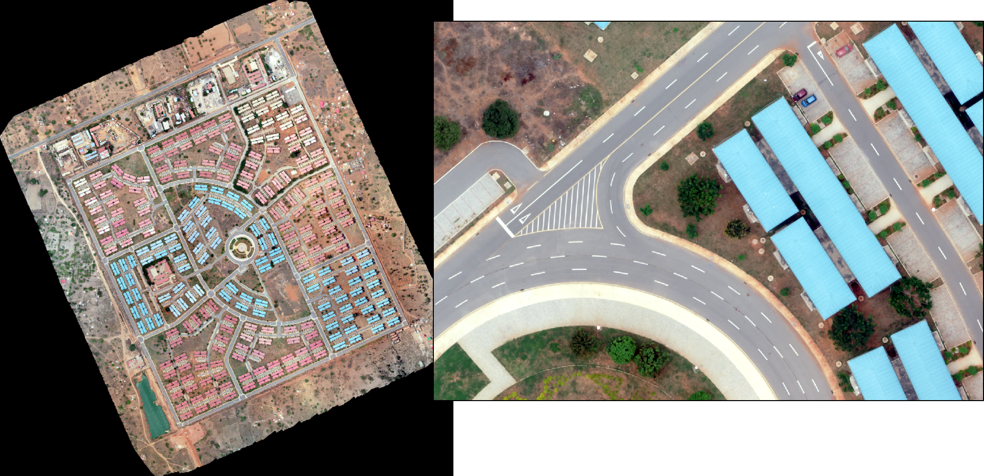
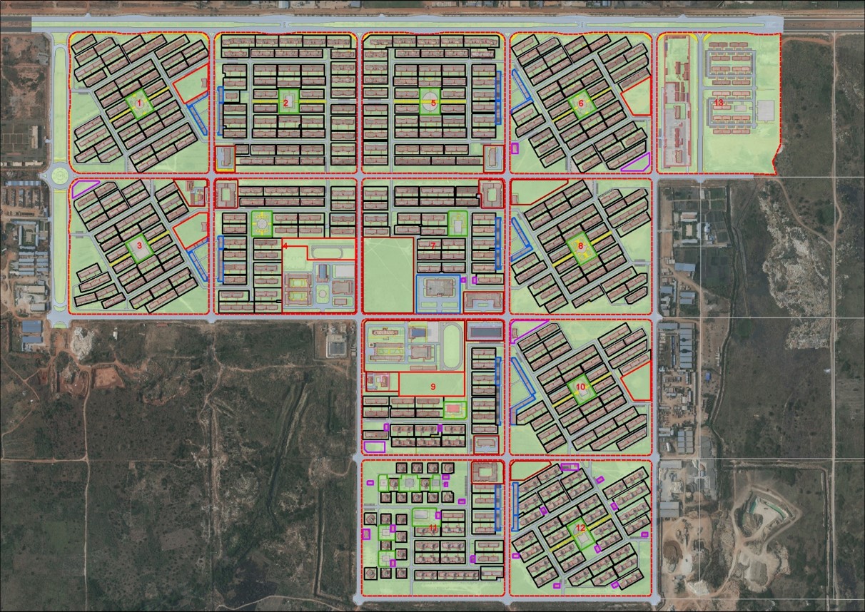
Promoting the legalization and regularization of land rights and property ownership is a strategic goal of Angola’s government. Based on parcel boundaries determined by expert surveyors, Geodata devised and built a nationwide cadaster system. Covering some 350 square kilometers, its database includes 400,000 parcels (land boundaries with digital coordinates), high resolution aerial imagery and detailed photogrammetric mapping, as well as street
and house addresses and geolocated historical maps and documents.

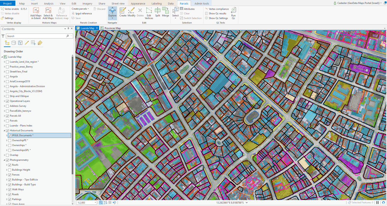
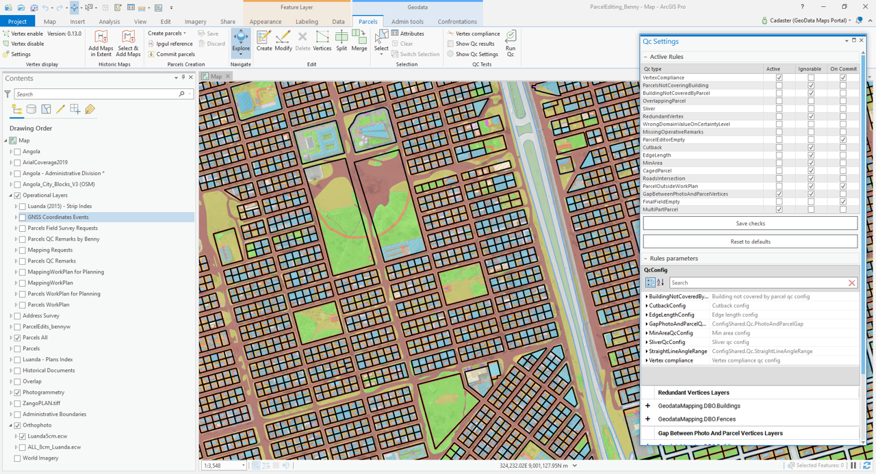
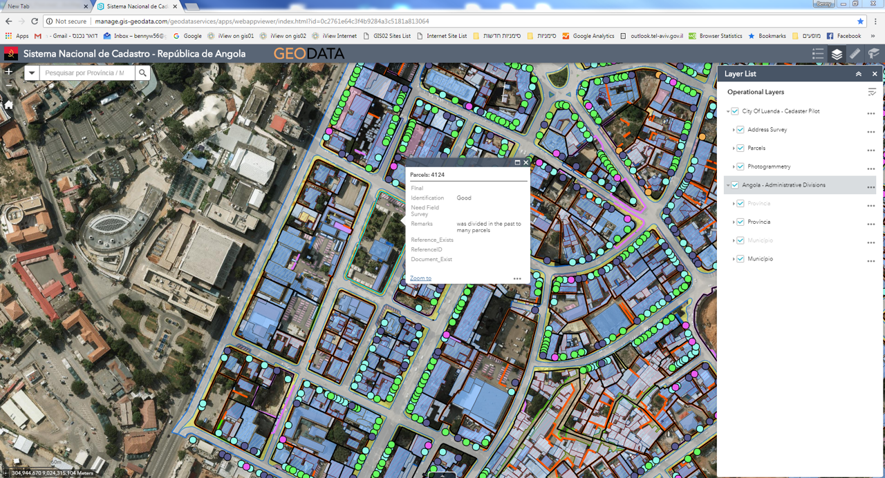
Geodata developed a unique Cadaster system that provides users with advanced editing and quality control tools and the ability to distribute cadaster data via a web-based GIS system. It provides Angola with the basis for a nationwide land management system to help with development and decision making.

The process

Challenge

Geodata had to design and implement Angola’s national cadaster database in a relatively short period of time, covering complex, dense and often irregular urban areas without sacrificing accuracy.

Approach

We developed a well-defined methodology and established an efficient production line.

Solution

An integrated system based on accurate parcel-based land information, aerial imagery, photogrammetric mapping and historical maps.

Some numbers

SDGs we followed

8· 10· 11

Decent work and economic growth• Reduced inequalities• Sustainable cities and communities

Projects covering some

350 km²

Database of some

400K

parcels (land boundaries with digital coordinates).

Some numbers

SDGs we followed

8· 10· 11

Decent work and economic growth• Reduced inequalities• Sustainable cities and communities

Projects covering some

350 km²

Database of some

400K

parcels (land boundaries with digital coordinates).

In conversation
with Daniel Costa

Daniel Costa is a Team Manager and GIS Supervisor.

I have a strong academic background in urban and regional planning with a degree in Geography. For more than a decade, I have worked on projects in the UK, East Timor, Portugal and Angola.

I manage teams doing field surveys, while coordinating and implementing our cadaster activities in Angola. We collect various types of data in order to build and update GIS databases. In addition, we provide training for local staff and support services for the cadaster system nationwide.

“We provide training for local staff and support services for the cadaster system nationwide."

Tags related to this project